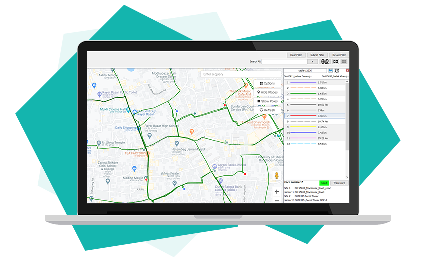
Satellite map

Have a large and complex outdoor cable network and tearing your hairs maintaining it? NetAppio is here to save you. To complement your logical diagram of the network, NetAppio features a detailed satellite map where your nodes and links will be connected to geographical locations to make one seamless picture. NetAppio’s satellite map allows you to manage your entire outdoor cable network starting from an ODF (Optical Distribution Frame) inside your datacenter to the fiber cores inside multicore cables, traversing several joint-boxes, possibly interchanging carrying cores several times and finally reaching its destination interface. NetAppio lets you trace any fiber core to graphically show its path and interconnections inside joint-boxes – a set of data otherwise would take you more than 5 minutes to compile. Your outdoor network troubleshooting will be a no-brainer with NetAppio’s help.
Satellite map highlights
- Create new sites and PoPs with 1 click
- Easy to setup and draw cables and related inventories
- Join cable cores inside joint-box with drag&drop
- Assist cable repairers and cable layers with interconnection diagram of joint-boxes
- Trace any cable core from source to destination
- View if a core is carrying live data or free
- Get detailed report of your cable inventory
- Jump between logical topology and satellite map
- Detect fault and mobilize team to repair within minutes
- Detect high fiber-loss and find alternate paths to re-route traffic
- Plan your network growth that is geographically suitable